|
|
Charting the Indian Ocean from Zanzibar to Sumatra
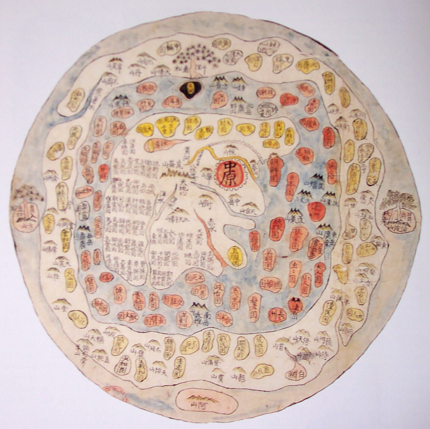
IV. THE APPROACH TO THE INDIAN OCEAN FROM CHINAThe earliest recorded map in Chinese literature dates to 227 B.C.E. and, although China claims to rank first in the world in terms of mapping history, her cartographers directed their attention almost exclusively to local, regional, and, at most, country-wide portrayals. Most maps were produced on wood (sometimes bamboo), silk, and, after the invention of paper in the early 2nd century C.E., on paper. Some were done on stone stele. The father of Chinese cartography was Pei Xiu (224-71 C.E.), who not only drew a map of China on a scale of 500 li (about one-third of a mile) to an inch, but also established certain principles of cartography, such as dividing the map into equal squares in order to show proportionality, that guided his successors for centuries.
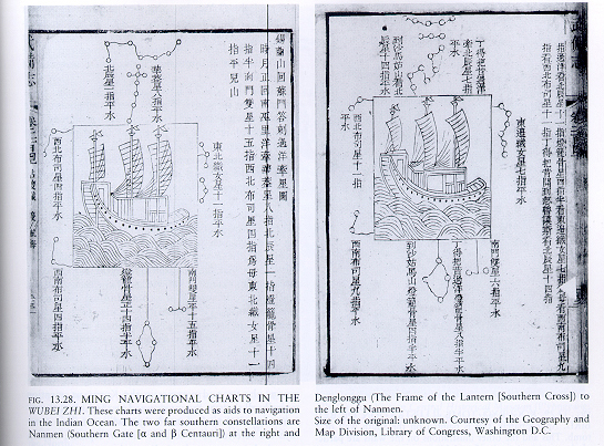
The most famous of all Chinese maritime activities were the seven voyages of Zheng He (1371-1434 C.E.) to the Indian Ocean early in the fifteenth century. The source of his initial navigational knowledge is unknown, but presumably it was obtained in piecemeal fashion from coastal Chinese merchants. A navigational chart of Zheng Hes voyages, particularly the seventh, has been preserved in the Wubei Zhi (Treatise on Military Preparations), compiled about 1621 C.E. by Mao Yuanyi. It shows coastlines, ports, island, shores and reefs at high tide, and such landmarks as pagodas and temples. The routes are marked with bearings and distances, as well as soundings in some locations. The chart carries over five hundred place names, including more than three hundred of foreign countries, a great contribution to understanding Indian Ocean geography, since Zheng Hes travels took him as far west as Hormuz and Kilwa Kisiwani in todays Tanzania.
Even in the sixteenth century, the Chinese persisted in the view that the earth is flat (while the Greeks had decided that the earth is a sphere two millennia before) and that China is the center of the universe. It was a rude awakening for them when the Jesuit priest, Matteo Ricci, prepared maps for them late in the century that showed the true size of China relative to the rest of the world.
Home|
The West
| Charting
| Commerce
| Madras
| Picturesque
| The
Horn
The web sites include links to sites outside the control of the authors. The authors are not responsible for information on these or other such linked sites. Please respect the copyright notices attached to the Web Sites you view.
© 2002 Penelope Campbell. All rights reserved.