
Landscapes of Movement
Trails, Paths, and Roads in Anthropological Perspective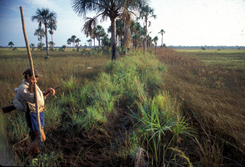
A Road by Any Other Name: Trails, Paths, and Roads in Maya Language and Thought (pdf)
Angela H. Keller
Emergent Landscapes of Movement in Early Bronze Age Northern Mesopotamia (pdf)
Figures (pdf)
Jason Ur (Harvard University)
Agency, Roads, and the Landscapes of Everyday Life in the Bolivian Amazon (pdf)
Figures (pdf)
Clark L. Erickson (U. of Pennsylvania)
J. Andrew Darling (Gila River Indian Community, Cultural Resource Management Program)
What is infrastructure? It is the interacting set of human ideas and materials—the basic facilities and equipment—that allow a society to function. All societies have it, but it is rarely appreciated, at least not until the system breaks down. What was Native American infrastructure like before the arrival of Euro-Americans? This question is examined through a consideration of the O’odham concept of himdag (tradition or “to follow the good path”) as “infrastructure”. Detailed analysis of archaeological trails in the northern Pimería Alta provides insights into the articulation of actor-travelers with trail systems and the ideological aspects of journeying.
Ritual Road Networks in the Bolivian Altiplano
Clark L. Erickson (U. of Pennsylvania)
Kristen Gardella (U. of Pennsylvania)
Formal roads are often the most visible components of pre-Columbian natural landscapes in the Americas. As engineered and highly patterned landscape features, road networks often map social, political, and economic realms. Roads that span generations can serve as models for society through repetitive utilitarian use, as political statements, markers of cultural identity and affiliation, and representations of cosmic order. In this presentation, we discuss the complex ritual road networks of the Carangas region of the Altiplano of western Bolivia. We explore a number of explanations of their use and meaning through ethnographic and historical analogy and GIS analysis.
Pre-Columbian Roads as Landscape Capital
Figures (pdf)
Clark L. Erickson (U. of Pennsylvania)
John Walker (U. of Pennsylvania)
Archaeological remains of roads are often neglected in settlement surveys. Because they are found between sites, roads are an important component of the landscape. In this paper, we apply the concept of landscape capital as defined by Harold Brookfield to pre-Columbian roads in the Amazon region of northeastern Bolivia. Previous studies have documented the importance of raised earthen causeways for transportation and communication between settlements across the seasonally inundated savannas. In this paper, we propose that farmers also used networks of causeways to manage water for savanna agriculture. Topography and cultural features at local and regional scales are modeled to simulate floodwater flow and capture within fields. The results provide insights about how generations of farmers engineered and managed this environment as landscape capital.
Kuktayma: Searching for Hopi Trails
T. J. Ferguson (Anthropological Research, L.L. C.)
G. Lennis Berlin (Northern Arizona U.)
Leigh J. Kuwanwisiwma (Hopi Cultural Preservation Office)
Hopi trails are an integral part of the cultural landscape that defines Hopitutuskwa (Hopi land). These trails connect villages on the Hopi Mesas with resources and sacred areas in the surrounding region. Centuries of use of Hopi trails have left physical traces on the land but these are often so subtle that many archaeologists fail to recognize them. Research on Hopi trails to the Grand Canyon and Zuni Salt Lake, conducted in association with the Hopi Tribe, has documented archaeological and morphological attributes of trails. In this paper, we review the cultural importance of Hopi trails and describe a methodology of remote sensing and ground verification that enables their recognition.
Trails in the Northern Mojave Desert: Isabel Kelly's Southern Paiute Data, 1932-33
Catherine S. Fowler (U. of Nevada, Reno)
In the early 1930s, Isabel Kelly obtained considerable data on trails used by Chemehuevi and Southern Paiute people throughout the Mojave Desert. She attempted to map these as best she could, and to locate all of the springs and other places that individuals could remember and name for her, along with their memories of travel along these routes. These data are being transferred to modern maps, and attempts are being made to locate many of the places Kelly recorded, along with the most likely locations of the trails. Several of the trails link up to other known trails used by the Walapai, Mojave and other peoples in the Mojave Desert and beyond. They help establish the networks of travel and contacts throughout the Southwest and southern California that were also the cultural pathways for trade and exchange, probably dating back several millennia.
Trails, Lava Fields, Stone Circles, and Ice Caves: The Prehistoric Landscape of El Malpais, New Mexico
Melissa Powell (Museum of Indian Arts & Culture)
The study of trails is gaining new attention as an approach to landscape analysis. Trails reflect routes of travel and the world view of those who journeyed along their paths. This paper explores the role and significance of prehistoric trails at El Malpais, an area once characterized as a buffer zone between cultural groups. Recent archaeological survey has begun to document an extensive trail network crossing a rugged volcanic landscape, linking stone circles, markers, shrines, and ice caves in an integrated system of social interaction. The study of El Malpais trails provides insight on traditional cultural knowledge and landscape use.
From Footpath to Monumental Entrance: A proposed Relationship in Ancient Costa Rica
Payson Sheets (U. of Colorado)
I propose a relationship between the footpaths entering cemeteries of egalitarian societies in ancient Costa Rica and the monumental entrances of later chiefdoms. Around 2000 BP the sustained use of a straight path to cemeteries had the unanticipated consequence of causing linear erosion and deep entrenching. The cultural prescription may have developed of seeing little along the deep path until one enters and sees the sacred cemetery landscape open up. The big chiefdoms that developed after 1000 BP constructed monumental entrenched entrances, perhaps based on what had become a cultural standard in simpler times.
Creating Human Space: Paths and Trails in the Ancestral Pueblo Landscape (pdf)
James E. Snead (George Mason U.)
The development of landscape perspectives has created new opportunities for the study of paths and trails in the archaeological record. Long a subject of anecdote, these features are now recognized not only as reflections of patterns of movement, but also as materialized relationships between and within communities, frameworks for social and political interaction that in and of themselves are invested with meaning. The excellent preservation of Ancestral Pueblo trails on the Pajarito Plateau of New Mexico makes it possible to plot such relationships through them and to evaluate the role of trails as active elements in the creation of place and identity.
From
the Ground Up: The Formalization of Footpath Networks in New World
Middle Range Societies
Devin White (U. of Colorado)
This paper seeks to understand the motivations and
mechanisms behind the
formalization of footpaths and associated networks as social complexity
increases. Examples from middle range societies in the North American
Southwest and Central America will be used to examine how the character
and structure of paths and broader networks change due to the increasing
societal need for more ideological, political, and/or economic integration.
Footpath and road networks associated with chiefly centers in Costa Rica
and
large sites within the Chacoan and Hohokam regional systems will be analyzed,
along
with related monumental architecture and landscapes, to determine patterns
of
path and network development and how they compare across regions that
differ
greatly in climate, demographics, and geography.
From path to myth: Journeys and the naturalization of nation on the Missouri River
Maria-Nieves Zedeño (U. of Arizona)
We examine the importance of pathways and the behaviors associated with their use in the formation of social identity and the consolidation of political institutions and territories. The cultural and geographical history of the Missouri River and its system of native land trails and waterways provides the background for this exercise. We argue the experiences lived along pathways, including the testing and use of resources, interaction with other groups, practice of ritual, or learning and naming new landscape features play a critical role in the naturalization of nation because they help establish and legitimize rights to land. Individual and group journeys become consolidated into the collective memory, and in time they give rise to origin myths. Myth in turn shapes memory and experience thus naturalizing cultural reality.
Participants & Areas of Research